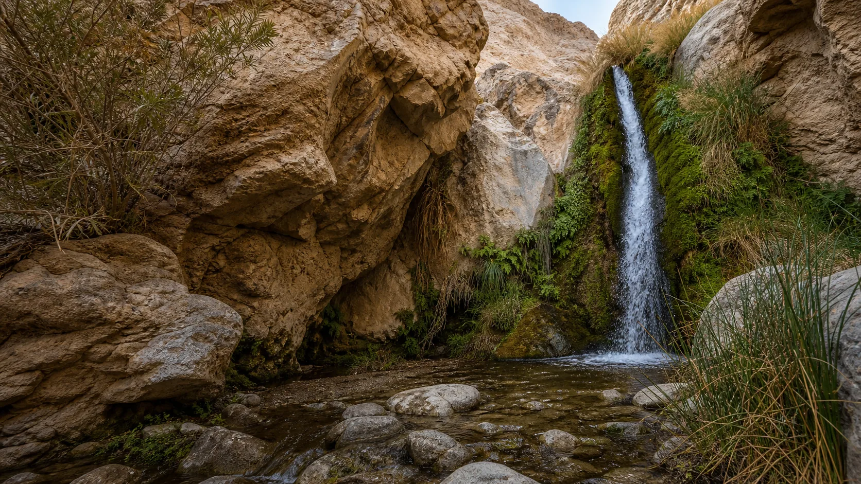
Is Darwin Falls worth hiking?
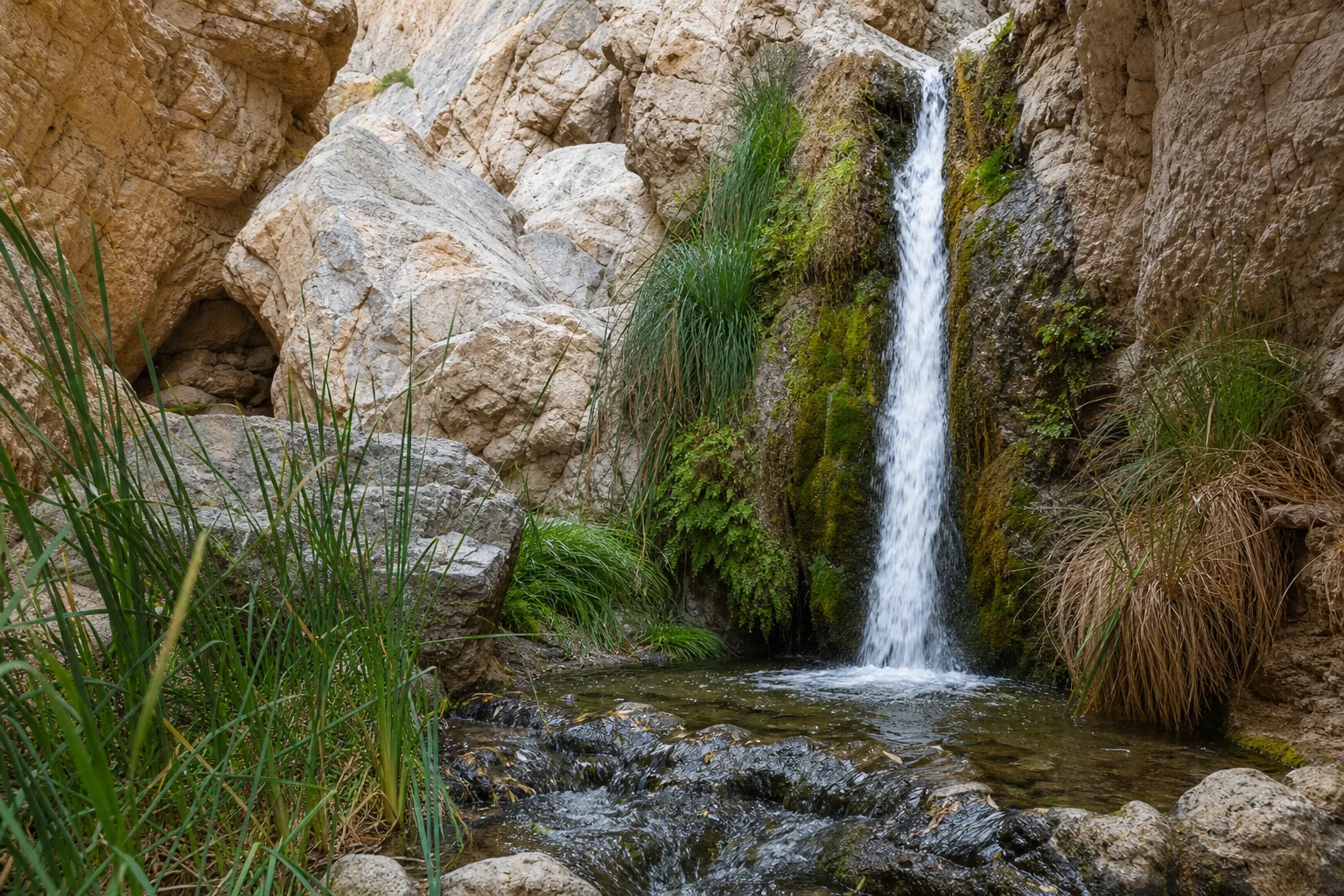
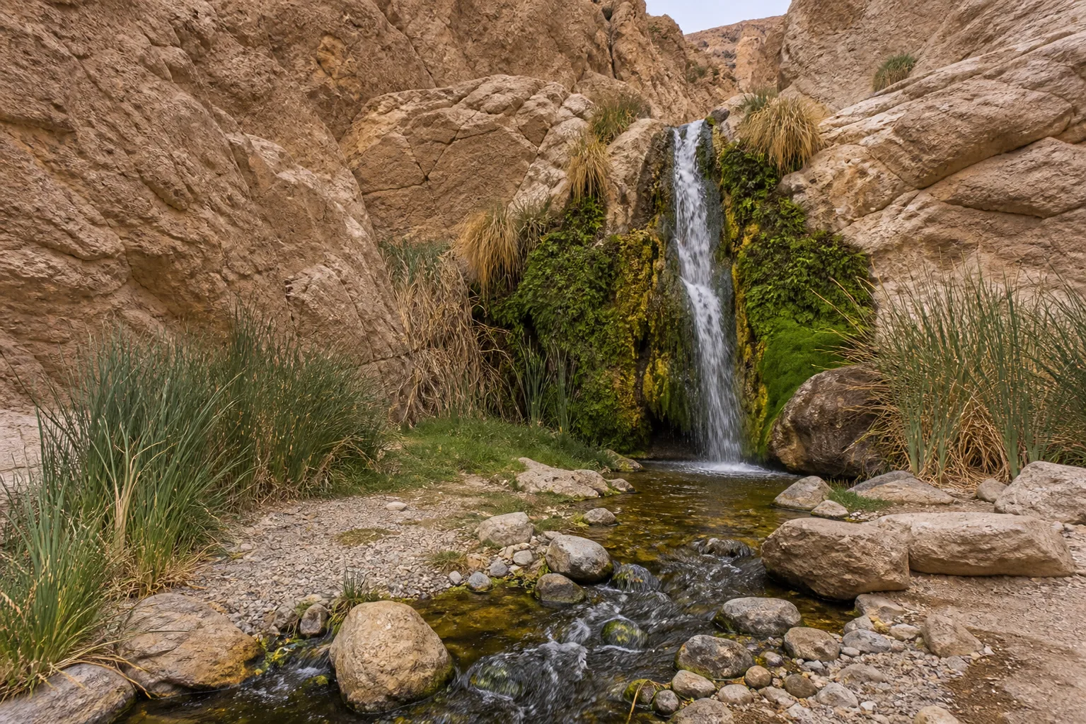
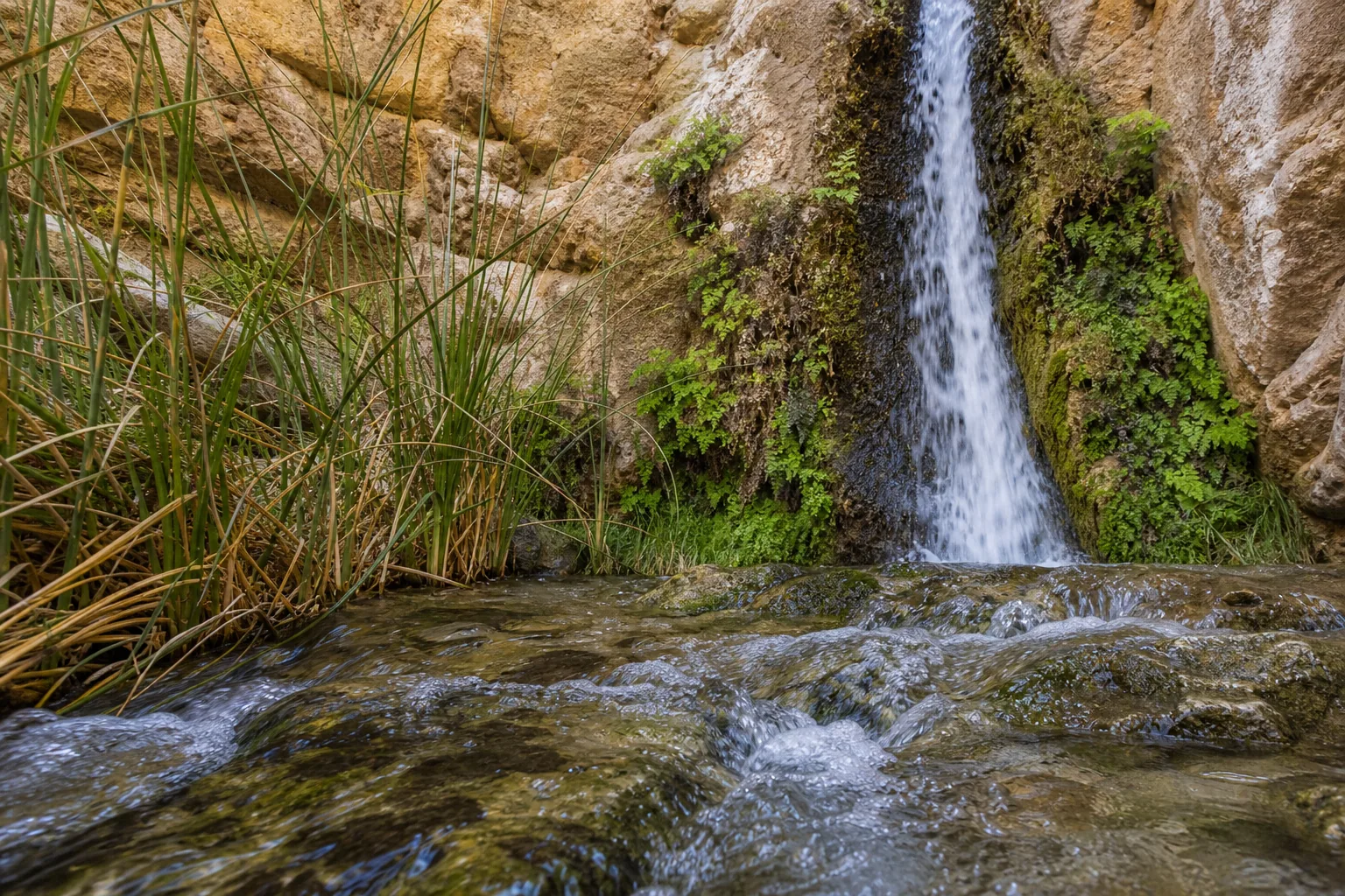
Yes, if you treat it as the desert oasis it is rather than as a Yosemite-scale cascade. Darwin Falls is one of only a handful of year-round waterfalls in Death Valley National Park, fed by a permanent spring that surfaces inside a canyon you would never guess held water. The lower drop visible from the maintained trail is about 18 feet; two additional upper tiers stack to roughly 80 feet for the full system. The approach is a rough 2.5-mile dirt road off CA-190 (slow but passenger-car possible in dry conditions) plus a 2-mile out-and-back hike with rock scrambles and no shade. No swimming, no dogs, $30 park entry.
- 2 miles round trip from the trailhead, ~200 ft of gain on a rocky desert wash
- Access by a rough 2.5-mile dirt road off CA-190; passenger car possible but slow in dry conditions
- 80-foot multi-tier spring-fed system; lower visible drop is roughly 18 ft
- Free to hike; $30 Death Valley vehicle entrance, valid 7 days
- Year-round flow from a permanent spring; one of the only reliable waterfalls in Death Valley
- No dogs on any park trail, no swimming (the pool is a drinking-water source)
Last verified May 12, 2026
Visited Desk-verified May 2026
7 sources checked